
Seasonal models are forecasting an el niño that could be the strongest ever, and meteorologist Jeff Berardelli warned the system could produce weather the modern record has never seen. "Creo que vamos a ver eventos meteorológicos que nunca hemos visto antes en la historia moderna," he said, laying out the stakes as agencies tighten forecasts for the coming months.
The warning is not idle speculation: Meteored has placed the chance that this El Niño will be strong or very strong at about 70 percent, while the U.S. National Oceanic and Atmospheric Administration says El Niño could arrive by July and judges the probability of a so‑called Super El Niño at roughly 30 percent. Daniel Swain of the climate science community said the subsurface warm anomalies now building are "approximately as large as those we have observed in the historical record," a signal scientists regard as one of the key ingredients for a major event.
The World Meteorological Organization has concluded that an episode of El Niño is likely to develop from mid‑year, while also cautioning that models are harder to pin down at this stage in the season. Wilfran Moufouma Okia told researchers there is a high degree of certainty that El Niño will begin and then intensify in subsequent months. NOAA’s timeline and the WMO notice together compress the window for planning: the system could be in place by July and build through the late northern summer and autumn.
Those timelines matter because the climate fingerprints of a strong El Niño are broad and immediate. Jeff Berardelli said warmer Pacific seas act like a supercharger for the global climate: "If the Pacific releases a lot of heat, that supercharges the climate system and wreaks havoc — with stronger heat waves, worsened drought in some places and heavier flooding where the air holds more moisture." He added specific regional expectations: the Caribbean will be especially dry this boreal summer and will likely see fewer Atlantic tropical systems, and the United States should expect a hotter‑than‑normal summer with significant heat waves and more frequent thunderstorms in the Southwest.
Mexico is already flagged as vulnerable: a strengthened El Niño could drive more intense Pacific storms and hurricanes that hit states including Oaxaca, Guerrero, Jalisco and Baja California Sur, and could also trigger extremes—either heavy rains and flooding in some areas or reduced rains and higher temperatures in others. The National Autonomous University of Mexico (UNAM) noted one of the phenomenon’s major oceanic effects is reduced upwelling of cold, nutrient‑rich waters; that drop in nutrients cuts phytoplankton production and, in turn, depresses fish, bird and marine mammal populations.
There is a historical reference point that sharpens both alarm and caution. NASA recorded an unusual 2.5 to 3 degrees Celsius rise in surface temperatures across the central and eastern Pacific during the 2015–2016 El Niño, a benchmark many scientists invoke when they use labels such as "super‑Niño" or the popular nicknames that surfaced after 2015, including the monikers Luisa Machain Castillo has traced to that period. In February 2026, scientists adopted the Relative Oceanic Niño Index to help quantify future events, a procedural shift intended to make comparisons with episodes like 2015–2016 more precise.
That precision matters because the story is not settled. Daniel Swain said flatly, "One of the key ingredients for it to fully materialize is, in fact, occurring," but he immediately added: "Aún no sabemos exactamente qué va a pasar. No está garantizado que sea un super‑Niño. Pero existe el potencial de que ocurra algo verdaderamente notable." The tension is clear: models and some indicators point toward a potentially historic El Niño, yet probabilities and expert caveats keep the most extreme scenario from being a foregone conclusion.
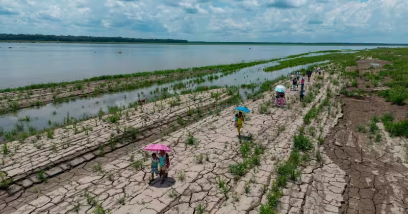
For governments, utilities and communities the practical next step is preparation on a compressed timeline. FilmoGaz’s earlier analysis, El Nino 2026 likely to strengthen this summer, raising odds of near‑record warmth, examined the mechanics now in play and the kinds of impacts to expect as the season unfolds. Whether El Niño becomes merely strong or escalates into a Super El Niño will determine where the worst damage lands — but even short of that worst case, the combination of hotter summers, amplified drought in parts of the Amazon (where about 40 percent of the forest suffers degradation) and the risk of extreme Pacific storms for Mexico argues for immediate contingency planning.
If the models are right and the Pacific does release unusually large amounts of heat this year, the result will be an annually rare reordering of weather patterns — accelerated warming, deeper droughts in some regions, heavier rainfall and flooding in others, and shifts in hurricane activity that will redistribute risk across basins. The critical question for the months ahead is not whether El Niño will arrive — agencies now place that likelihood high — but how intense it will become and which communities will bear the brunt of the change.