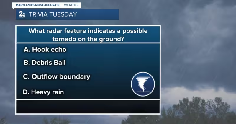
During Maryland's severe weather season, a Trivia Tuesday question asked, in the words of Dylan, "What radar feature indicates a possible tornado on the ground?"
The multiple-choice answers given were hook echo, debris ball, outflow boundary and heavy rain — and meteorologists say the correct pick is debris ball. Doppler radar, the tool meteorologists use to track storms, normally detects rain, snow or hail, but in rare scenarios it can pick up debris — trees, homes or vehicles lofted into the air by a tornado — and that return shows up on radar as a debris ball.
On radar a debris ball appears as a distinct bright red, pink or magenta area and is typically located just south of a hook echo. That placement matters because meteorologists often look for a hook echo when analyzing radar since a hook can indicate a rotating thunderstorm. But rotation alone does not necessarily mean a tornado is on the ground; the debris ball is the number one radar signature that indicates a tornado is actually lofting and throwing material into the air.
That distinction is not academic. Doppler radar helps meteorologists save lives during severe weather by giving them the ability to see storm structure and make warnings. A hook echo can be an early clue that a storm is rotating and deserves close attention. A debris ball is the stronger confirmation that the rotation has likely produced a tornado that is causing damage on the ground and lofting debris into the air.



Maryland is heading into the heart of severe weather season, and the Trivia Tuesday prompt landed against that backdrop. The question framed a common public misconception: that a hook echo alone is proof of a tornado on the ground. Meteorologists explained during the piece that while a hook echo can show rotation, it does not prove a tornado is occurring at the surface. Only the debris ball — the concentrated magenta echo corresponding to non-meteorological scatter — serves as the clearest radar signal that debris is being thrown aloft.
The friction point for forecasters and the public is that radar normally measures precipitation particles, not chunks of houses or trees. For a radar to show debris, a storm has to be strong enough to loft sizable objects into the beam and those objects must be returned to the radar as a coherent, high-reflectivity feature. Because that scenario is rare, a lack of a debris ball does not mean a tornado is not present, and the presence of a hook echo still matters for early warning.
That gap—between the useful early-warning cue of a hook echo and the confirmatory power of a debris ball—shapes how warnings are issued. Forecasters rely on rotation indicators to alert communities and then look for debris signatures to upgrade the warning to an immediate, ground-impact threat. The technical reality is straightforward: the debris ball is the most definitive radar sign that a tornado is on the ground, while the hook echo is the more common, earlier indicator of storm rotation that demands vigilance.
For anyone following storms in Maryland this season, the takeaway from the Trivia Tuesday exercise is practical: watch for the hook echo as an alarm and for the debris ball as confirmation. Tornado radar can do both jobs, but only the debris ball should be treated as the clearest radar proof that a tornado is lofting debris and striking the surface.