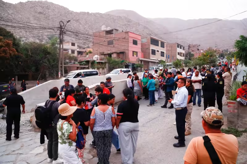
A 5.8-magnitude earth quake struck the Pacific region of southern Peru late Tuesday, injuring 27 people but causing no reported deaths, authorities said as Peruvian Defense Minister Amadeo Flores toured the hardest-hit city of Ica.
The U.S. Geological Survey placed the quake’s epicenter about 20 kilometers east-southeast of Pampa de Tate in the Ica region and measured a depth of 56.5 kilometers. Officials said the shaking damaged buildings across the city; Flores visited several of those sites, including San Luis Gonzaga University, in the immediate aftermath.
Local emergency services reported 27 people sustained injuries; there were no fatalities reported following the event. The visit by Defense Minister Amadeo Flores came after initial on-the-ground assessments identified visible structural damage to public and institutional buildings, which officials reviewed as part of an early response effort.
Official seismic bulletins published after the event show differing technical readings. An IGP/CENSIS report recorded the quake at magnitude 6.1 with a depth of 81 kilometers, placing its reference point about 41 kilometers south of Ica and assigning an intensity of VI in the city at 19/05/2026 12:57:51 local time. Those numbers contrast with the U.S. Geological Survey’s 5.8 magnitude and the 56.5-kilometer depth it reported.
Those inconsistencies are not uncommon in the hours after a quake, when multiple monitoring agencies use different instruments and models. Still, they matter for a practical reason: magnitude, depth and epicenter location are the primary inputs used by engineers and emergency managers to estimate which neighborhoods experienced the strongest shaking and which structures are most at risk.
Ica, the regional city where damage was concentrated, felt shaking that local seismic authorities classified as intensity VI. Emergency crews and defense ministry teams have been inspecting schools, hospitals and other public buildings to determine immediate safety risks and identify sites that may require closure or more detailed engineering surveys.
The diverging technical readings also influence public messaging. A higher magnitude or shallower depth can suggest stronger surface shaking and a greater potential for aftershocks that cause additional damage; a deeper quake often produces lower surface acceleration but can affect a broader area. Officials cited the various agency bulletins as they coordinated medical aid and structural assessments across affected neighborhoods.
For residents and authorities in Ica, the immediate priority is clear: tend to the injured, secure unsafe buildings and reconcile the scientific record so repairs and safety orders match the hazard. Minister Amadeo Flores’s inspection of San Luis Gonzaga University and other damaged sites was part of that rapid response, bringing national-level attention to visible destruction and the need to certify which facilities are safe to reopen.
What remains unresolved is how the conflicting readings will change the official damage tally and the next phase of the response. The most consequential question facing officials now is whether a consolidated seismic analysis will prompt wider evacuations, extended closures of critical infrastructure, or a revised assessment of aftershock risk that alters recovery operations. How authorities answer that will determine whether the Ica region moves quickly from emergency response to reconstruction or must brace for further shocks while damage assessments continue.