
Phoenix reached 99 degrees on the afternoon of the report, a degree above the seasonal average of 97, as the city moved into a stretch that will start warm and ease later in the week. Tonight is expected to stay mostly clear, with overnight lows settling into the mid-70s.
The weekend keeps the heat close to normal. Phoenix Valley highs are expected to run in the 99-100 range on Sunday, with only a slight chance for a few light showers over the higher terrain southeast of Phoenix late Sunday into early Monday. By Memorial Day, Phoenix is forecast to reach a high near 98 degrees.
The bigger weather story on Monday is not in the Valley, but farther north and southeast. Scattered showers and thunderstorms are expected across northern and southeastern Arizona, including around Flagstaff and the White Mountains, where rain chances in the High Country are forecast at 50 to 60 percent. That leaves Phoenix dry through the holiday itself while nearby regions see a better shot at storms.
Tuesday should bring a return to quieter weather in the Valley, with mostly sunny skies and highs in the mid to upper 90s. Winds are expected to become a bit breezier on Wednesday, when temperatures in Phoenix are forecast to dip slightly below normal and top out near 95 degrees. Cooler conditions are possible on Thursday and Friday, with highs falling into the low 90s before temperatures rebound closer to average by Saturday near 97 degrees.
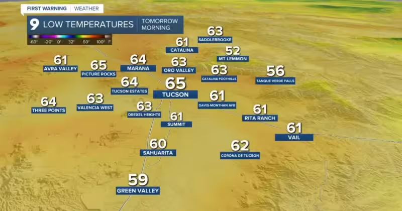
Farther south, Southeast Arizona is expected to stay dry through Saturday night before a slight chance of showers and thunderstorms develops Sunday afternoon into Monday, mainly east and southeast of Tucson. Any lingering precipitation chances could continue early Tuesday near the New Mexico state line. High temperatures across Southern Arizona are expected to stay within a couple degrees of normal through next week, even as the wind picks up. Breezy conditions are expected east of Tucson on Monday and Tuesday, with more widespread breezy to windy weather across Southeast Arizona on Wednesday and Thursday.
For now, the near-term forecast is straightforward: Phoenix stays hot but manageable through the holiday, then slides into a cooler stretch that brings the city a little below normal by midweek. The rain threat remains focused outside the Valley, where the High Country and parts of southeastern Arizona are the places most likely to see the first meaningful showers and thunderstorms.