
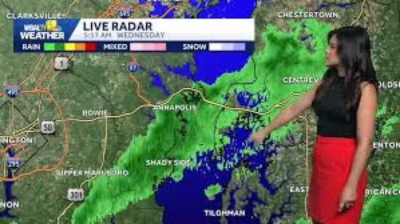
Scattered showers and storms are moving across Maryland on Wednesday, and some of them could bring heavy downpours and gusty winds. By 9:22 a.m. EDT on May 27, 2026, the first round had already exited the area, but another batch is due to hit central and northern Maryland from 10 a.m. through 2 p.m.
Patchy areas of dense fog were in place early Wednesday morning along with heavier showers and storms across northeastern Maryland, a sign of how unsettled the day began. The heaviest downpours are expected between 10 a.m. and 2 p.m., and an isolated severe storm cannot be ruled out in the Baltimore area, though the greatest risk for severe weather stays to the south.
That southern focus matters most for the places that face the highest odds of damaging wind gusts later Wednesday, with the better chance centered south of Baltimore City and closer to southern Maryland and the lower eastern shore. Most places should start to dry out by mid-afternoon, but a leftover spotty shower or storm could linger into early evening, keeping the forecast from turning fully quiet right away.
For Baltimore, the bigger question is less about whether the day gets wet and more about how long the disruption lasts. The answer is that the strongest threat is front-loaded into late morning and early afternoon, while the late-day window improves quickly as the system slides out and the weather starts to settle.

That matters for the Orioles game Wednesday evening, which looks dry. The sky is expected to be mostly cloudy to cloudy, with warm and humid conditions holding temperatures in the mid to upper 70s throughout the game.
Thursday brings a different feel. It starts with clouds, humidity and an isolated sprinkle or shower, then gusty northwest winds are expected to pick up during the day and flush the humidity out by afternoon. Highs should reach the upper 70s to lower 80s, making it a refreshing and beautiful change after the muggy start.
The end of the week looks steadier. Friday through Sunday is forecast to be dry and seasonable, with each day beginning in the 50s and warming into the 70s by afternoon. The chance of a light passing shower this weekend is very low, and the stretch should be drier than the Memorial Day weekend just behind it.
The next meaningful question is whether the start of next week stays dry. Rain chances may increase, but there is still a good deal of uncertainty about how that pattern will unfold.