Most of North Texas will get a break from the rain on Friday, with drier conditions and only a very limited chance of showers. A few light, isolated showers could still pop up during the day, but the vast majority of the region is expected to stay dry as temperatures climb into the 80s.
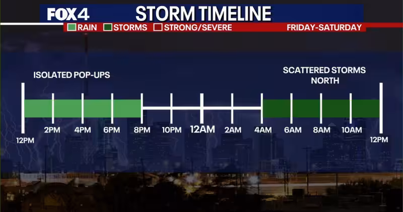
The calmer weather will not last long. An atmospheric disturbance is expected to move in Friday night, bringing scattered showers and thunderstorms that could linger into Saturday morning. More rounds of scattered storms are expected Saturday afternoon and evening, and forecasters say thunderstorms are possible somewhere in North Texas each day this weekend.


For people trying to make Memorial Day weekend plans, that means the forecast is workable but not clean. The overall threat of severe weather remains low, but a few storms could still produce hail and gusty winds, enough to interrupt outdoor plans or slow travel if storms form nearby.
The weekend pattern fits a broader setup that keeps most of North Texas dry Friday before storm chances return. Rain chances are expected to drop to a lower coverage Sunday through Tuesday, but not disappear entirely. Forecasters are urging anyone with outdoor plans to stay weather aware, especially because even a low-end threat can turn fast when storms build in warm, unsettled air.
Boaters have the sharpest warning. If a storm approaches, they should be ready to seek shelter immediately and keep a portable weather radio on board to monitor changing conditions. That matters most this weekend, when scattered storms could develop with little warning and move through parts of North Texas while many people are outside for the holiday.